Council Composition and Ward Boundary Review | Municipality of Chatham-Kent
Chatham-Kent, Ontario
Client
Municipality of Chatham-Kent
Dates
2024
Services
GIS Services
Geospatial Analysis
Statistical Analysis
Population Modeling
Mapping
Team
StrategyCorp
Sajecki Planning undertook geospatial and statistical analysis to support the creation of the new ward boundary options. The review began with an in-depth analysis of the current population’s distribution across the municipality. Sajecki Planning and StrategyCorp then worked with the municipality to accurately project population growth through 2030. The projected growth of permanent and seasonal residents, temporary foreign workers, and out of town students was modeled.
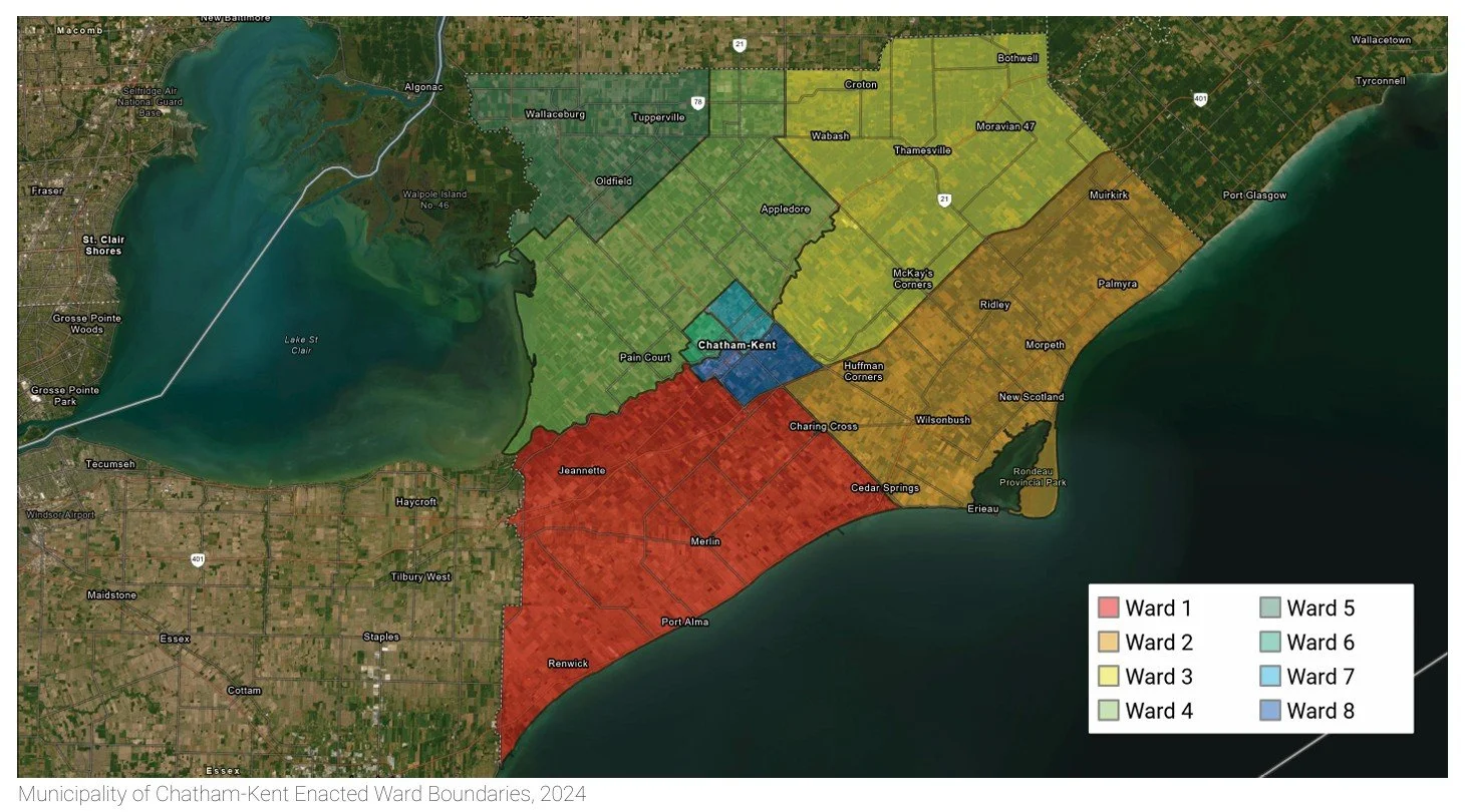
Based on these projections and considerations for community interests and the extent of natural features, new ward boundary options will be prepared and presented to the public for feedback before being considered by Council. A key challenge of the project is balancing urban and rural interests and ensuring fair representation within each ward.
Council decided to reduce their size from 18 to 14 Councillors and a Mayor and increase the number of wards from six to eight. This project marked the first time Chatham-Kent updated their ward boundaries since amalgamation in 1998.